Mission Archive

Portfolio

Real missions. Real deliverables. A sample of what our pilots produce in the field — from cell tower 3D models to large-scale construction progress and wildlife assessments.

Cell Tower 3D Model
Inspection

Cell Tower 3D Model

Central US·Telecom Client

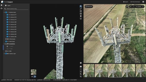
Full photogrammetric 3D model of a cellular tower generated from drone imagery using PIX4Dinspect. Every antenna, mount, and structural member catalogued without a single climber on the tower.

PIX4Dinspect3D ModelNo Shutdown
Cell Tower Inspection →
Cell Tower Inspection — Close-Range
Inspection

Cell Tower Inspection — Close-Range

Southeast US·Tower Owner

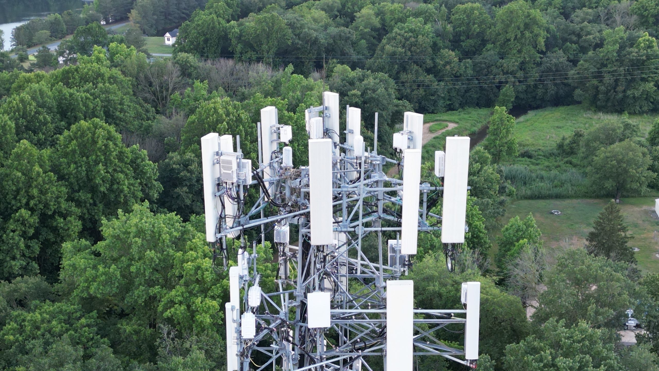
High-resolution close-range inspection of antenna arrays and mounting hardware. Delivered a full photo report with GPS-tagged findings — no tower crew required.

FAA Part 107Close-RangePhoto Report
Cell Tower Inspection →
Cell Tower — Aerial Overview
Inspection

Cell Tower — Aerial Overview

Southeast US·Tower Owner

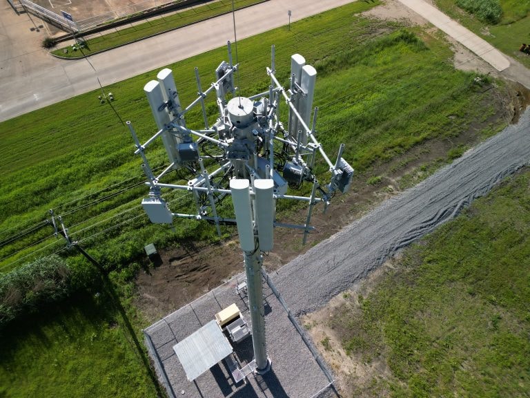
Aerial overview documentation of a full tower structure including guy wires, base, and surrounding clearance. Used for pre-maintenance planning and insurance documentation.

Aerial OverviewDocumentationInsurance
Cell Tower Inspection →
Microsoft Data Center — San Antonio
Construction

Microsoft Data Center — San Antonio

San Antonio, TX·General Contractor

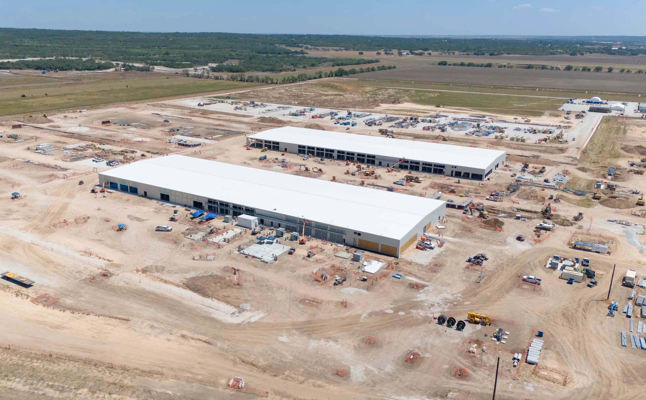
Aerial progress documentation of a large-scale Microsoft data center campus under construction in San Antonio. Multiple buildings, active equipment, and phased site work captured from above.

Large-ScaleProgress MonitoringCommercial
Construction Progress →
Cattle Herd Count — M4E
Wildlife

Cattle Herd Count — M4E

Southeast US·Ranch Owner

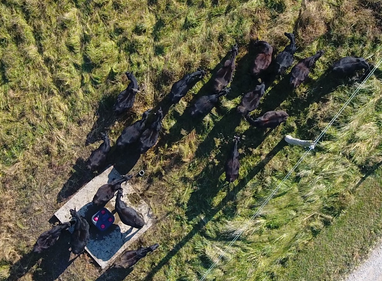
Overhead herd count of black Angus cattle using the DJI Matrice 4E. Raw imagery captured for manual count verification — every animal visible and individually identifiable from altitude.

DJI M4EHerd CountLivestock
Wildlife Assessment →
Annotated Herd Count Report
Wildlife

Annotated Herd Count Report

Southeast US·Ranch Owner

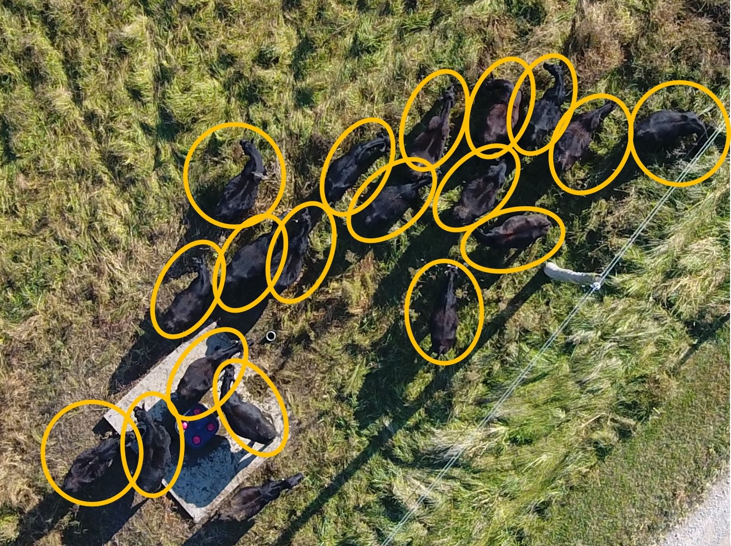
Post-processed herd count with individual animal annotations. Each head circled and counted — 20 animals confirmed in this frame. Delivered as a georeferenced report with total count and GPS coordinates.

Annotated Report±3% AccuracyLivestock
Wildlife Assessment →
Roof Thermal Inspection — IR
Thermal

Roof Thermal Inspection — IR

Alabama·Commercial Property Owner

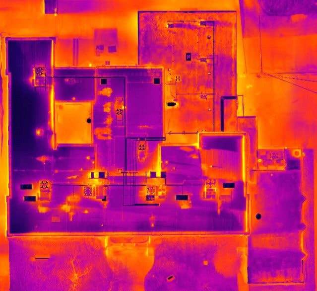
FLIR thermal scan of a commercial roof revealing moisture intrusion and heat loss patterns invisible to the naked eye. Delivered with GPS-tagged anomaly map and written findings.

FLIRMoisture DetectionLevel 2 Thermographer
Thermal Imaging →
Roof Inspection — Visible Spectrum
Thermal

Roof Inspection — Visible Spectrum

Alabama·Commercial Property Owner

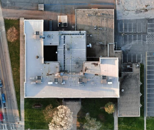
Visible-spectrum companion imagery to the thermal scan — same roof, same flight. Paired deliverable showing the physical condition alongside the thermal anomaly map.

Visible SpectrumPaired DeliverableCommercial Roof
Thermal Imaging →
Aerial Photography — Farmland
Aerial

Aerial Photography — Farmland

Alabama·Landowner

High-resolution aerial stills of Alabama river bottomland and farmland. Used for land marketing, boundary documentation, and property listing photography.

4KLand MarketingReal Estate
Aerial Photography →

Ready to Fly?

Let's add your project to the archive.

Every mission is different. Tell us what you need and we'll put the right pilot and equipment on it.

Request a Mission